

My University uses this website to get a more accurate prediction for snowfall amounts. Meteorologists post every day. Their prediction accuracy is much better than the network TV crap. It seems all the models are shifting Irene’s track westwards. One model has it hitting NYC directly. That would be a damned shame.

Eyeing Irene’s Encounter
A few caveats I’ll put out there. First, Irene will be a large storm when it gets to this latitude and will impact many (especially if the “close to coast” or inland track verifies) but it should not pack the same intensity punch (Category 3 status) to our latitude as ocean temperatures in this part of the world are lower than they are in the Bahamas. Hurricanes thrive on hot water and ocean temperatures locally are not conducive to supporting high intensity storms. Irene will probably not be as strong as she is now but still pack a wallop when it visits us on Sunday. Second, we probably have not seen the last of the nudges with this storm’s modeled path in either direction and it’s possible that we see a bit more nudging west or east in the coming day or two.

The models have shifted the storm’s projected track to the west, with the Euro taking Irene’s eye up the Chesapeake Bay through the western suburbs and north through the Poconos into Upstate New York after initial landfall in Eastern North Carolina. Irene could bring near hurricane force sustained winds on its eastern side to South Jersey Shore Points in this scenario, with higher gusts. Winds in Philadelphia could reach 50 mph in this scenario but the worst impacts would definitely be felt at the Shore from a wind and storm surge standpoint, with everyone impacted from heavy rainfall on the order of several inches. The surge of water pushing up Delaware Bay would result in potentially significant coastal flooding on southern facing beaches (NJ side) in Delaware Bay and then lead to the risk of reverse coastal flooding on the northern facing beaches (Lewes) as winds veer around after the eye passes by. The “saving grace” is that the landfall point being in the Carolinas would result in an inland track for Irene. The result of Irene’s center being removed from the Atlantic for a period of time could weaken the storm some from its landfall intensity. Definitely an ugly scenario but Irene is not as strong here as in the GFS’ case.

The GFS has a landfall point along the Jersey Shore and tracks the storm nearly over New York City. This is nearly as ugly a scenario as the models can envision for track. The storm will have had more time over water (granted, water not as warm but it’s still water and not land) and will be a bit stronger when it makes landfall. The storm track could result in hurricane force winds hammering the Jersey and Delaware coastlines and bring heavy rain to the entire region. Winds in Philly are not as strong in this scenario but we get a bit more rain in this scenario as we would be on the western side (rainy) of the storm.
One last point to make this morning: East of the “eye” will have stronger winds than west of the eye, with the eastern side of the storm providing a better potential for quick spin-up tornadoes compared to the western side. The west side of the storm provides a better potential for heavier rainfall. Unless the storm takes a track over 100 miles east of the coastline, the region will see impacts from it…unfortunately, some of those will be rather significant.


Landfall anywhere 150 miles north of Savannah will be fine with me, if it has to come ashore at all.
Hope the Washington Monumnet can take that much rain. John
Stop the drift! I liked it better 250 miles offshore when it passes my latitude! Of course, I live exactly in the center of the State of Florida – about 65 miles or so from either side – on purpose I might add – so I don’t fret anything that doesn’t come straight in from the coast.
Like the rain, don’t mind the squalls and thunder, prefer the winds to be under 50 MPH gusts. Over that, trees start to fall and my carport gets full of crap I have to clean up..
All ya’ll up the coast? Have a great weekend and maybe Admins’ wish of a 30′ storm surge up the Potomac to flush all the accumulate trash and cockroaches out of D.C. might come true!
MA
I’ve never watched “Jersey Shore”, but this could make for an entertaining episode. How will Snookie deal with this Situation?
I just got off the phone with our head of Operations from my School
She has a contact at the National Weather Service who she just talked to.
The hurricane situation is much worse than the media is reporting. The models are showing a direct hit on the Jersey shore with billions in damage. They are debating whether to order an evacuation. They will close the Garden State and make it one way out.
We are getting 2 to 4 inches of rain today. This front would normally move offshore but the hurricane will push it back over us on Saturday. There is a cold front coming down from Canada that will impede the hurricane from moving away from us. It could sit over us and just churn.
Get prepared for a Katrina like panic to ensue. Evidently the politicians don’t want to order an evacuation because it will cost millions. The meteorologists are telling them to do it now.
Jim….I bet there will be a run on water wings and other floaties….most of the FSA can swim !
admin, you serious?
RT
Deadly serious. I’m telling you exactly what our Operations Manager told me 30 minutes ago.
[img [/img]
[img [/img]
[img [/img]
WTNT44 KNHC 251455
TCDAT4
HURRICANE IRENE DISCUSSION NUMBER 21
NWS NATIONAL HURRICANE CENTER MIAMI FL AL092011
1100 AM EDT THU AUG 25 2011
IT HAS BEEN DIFFICULT TO DETERMINE WHETHER THE HURRICANE HAS GONE
THROUGH AN EYEWALL REPLACEMENT. ALTHOUGH THE RADIUS OF MAXIMUM WIND
IS LARGER TODAY THAN YESTERDAY…MICROWAVE AND AIRCRAFT DATA HAVE
NOT BEEN VERY CONCLUSIVE. RECENT DATA DO NOT SHOW ANY EVIDENCE OF A
SECONDARY EYEWALL AT THIS TIME. THE EYE IS A LITTLE MORE EVIDENT IN
THE LAST FEW VISIBLE SATELLITE IMAGES…BUT IS NOT AS CLEAR AS IT
WAS YESTERDAY MORNING. THE AIR FORCE AIRCRAFT HAS MEASURED A PEAK
FLIGHT-LEVEL WIND OF 112 KT AND SFMR WINDS OF 90 KT…WHICH ROUGHLY
SUPPORT THE 100-KT INITIAL INTENSITY.
CENTER FIXES FROM THE AIRCRAFT OVERNIGHT AND THIS MORNING INDICATE
THAT THE EXPECTED NORTH-NORTHWESTWARD TURN HAS OCCURRED. A
NORTHWARD TURN IS EXPECTED TONIGHT OR EARLY FRIDAY AS IRENE MOVES
THROUGH A BREAK IN THE SUBTROPICAL RIDGE. A MID/UPPER-LEVEL TROUGH
MOVING THROUGH THE GREAT LAKES REGION IS EXPECTED TO THEN TURN
IRENE TOWARD THE NORTH-NORTHEAST IN A COUPLE OF DAYS. THIS TROUGH
IS FORECAST TO BYPASS IRENE…LEAVING THE HURRICANE IN DEEP
SOUTHERLY FLOW BETWEEN A TROUGH OVER THE CENTRAL UNITED STATES AND
A BUILDING RIDGE OVER THE ATLANTIC. THIS PATTERN WILL LIKELY KEEP
THE HURRICANE VERY NEAR THE EAST COAST OF THE UNITED STATES. THE
GUIDANCE ENVELOPE HAS SHIFTED A LITTLE WESTWARD ON THIS CYCLE…AND
THE NEW OFFICIAL TRACK HAS BEEN NUDGED WEST AS WELL. THE NEW
FORECAST LIES BETWEEN THE GFS AND ECMWF…AND IS A LITTLE RIGHT OF
THE TVCA CONSENSUS. SINCE IRENE IS SUCH A LARGE TROPICAL
CYCLONE…SIGNIFICANT IMPACTS ARE LIKELY ALONG THE UNITED STATES
EAST COAST REGARDLESS OF THE EXACT TRACK IT TAKES.
THE ENVIRONMENT REMAINS CONDUCIVE FOR SOME ADDITIONAL STRENGTHENING
DURING THE NEXT DAY OR TWO. THE MAIN INFLUENCING FACTOR DURING THE
SHORT TERM WILL LIKELY BE EYEWALL CYCLES WHICH ARE DIFFICULT TO
PREDICT. AFTER 48 HOURS…SOUTHWESTERLY SHEAR IS FORECAST TO
INCREASE WHICH WILL LIKELY START WEAKENING PROCESS. HOWEVER…
SINCE IRENE HAS SUCH A LARGE AND INTENSE CIRCULATION…IT
WILL PROBABLY BE RATHER SLOW TO WEAKEN.
HAZARDS AFFECTING LAND
———————-
WIND…HURRICANE FORCE WINDS ARE CURRENTLY SPREADING OVER THE
NORTHWESTERN BAHAMAS. HURRICANE OR TROPICAL STORM FORCE WINDS ARE
STILL OCCURRING OVER PORTIONS OF THE CENTRAL BAHAMAS…BUT SHOULD
BEGIN TO DIMINISH LATER TODAY. TROPICAL STORM FORCE WINDS ARE
POSSIBLE WITHIN THE WATCH AREA ALONG THE COAST OF NORTH AND SOUTH
CAROLINA BY LATE FRIDAY.
STORM SURGE…IN AREAS OF ONSHORE WINDS NEAR THE CENTER OF IRENE…
AN EXTREMELY DANGEROUS STORM SURGE WILL RAISE WATER LEVELS BY AS
MUCH AS 7 TO 11 FEET ABOVE NORMAL TIDE LEVELS OVER THE CENTRAL AND
NORTHWEST BAHAMAS. WATER LEVELS WILL GRADUALLY SUBSIDE OVER THE
SOUTHEASTERN BAHAMAS THROUGH TONIGHT. NEAR THE COAST…THE SURGE
WILL BE ACCOMPANIED BY LARGE AND DANGEROUS WAVES.
RAINFALL…IRENE IS EXPECTED TO PRODUCE RAINFALL ACCUMULATIONS OF 6
TO 12 INCHES OVER THE BAHAMAS.
SURF…SWELLS GENERATED BY IRENE ARE AFFECTING PORTIONS OF THE COAST
OF THE SOUTHEASTERN UNITED STATES. THESE SWELLS WILL CAUSE
LIFE-THREATENING SURF AND RIP CURRENT CONDITIONS. PLEASE CONSULT
PRODUCTS FROM YOUR LOCAL NATIONAL WEATHER SERVICE FORECAST OFFICE.
NEXT ADVISORY
————-
NEXT INTERMEDIATE ADVISORY…200 PM EDT.
NEXT COMPLETE ADVISORY…500 PM EDT.
Mayor Bloomberg Tells Newyorkers To Prepare For Evacuation
Submitted by Tyler Durden on 08/25/2011 10:56 -0400
Anyone living in New York may want to read this Bloomberg article as it is important stuff, unlike anything coming out of Jim Cramer, who told everyone an hour ago that “this is a turning point, Buffett’s bailout marks the beginning of a massive multiday short-covering rally in the financials” – naturally the XLF is about to turn red.
Hurricane Irene May Require NYC Evacuations, Bloomberg Says
New York officials preparing for Hurricane Irene will decide tomorrow whether to call for the evacuation of low-lying areas in downtown Manhattan, Brooklyn, Queens and Staten Island, Mayor Michael Bloomberg said.
The decision would be based on the strength, path and speed of the storm, Bloomberg told reporters today at a news conference in a flood-prone section of Queens. The city would offer “an enormous shelter system” for those without a place to stay on higher ground, he said.
“We don’t have enough information yet to make that call,”
Bloomberg said. “The timing is a bit up in the air, as it is with all these things. Sometime on Friday, late in the day. How many depends on how severe we think the storm is going to be.”
The mayor has the power to issue an executive order to force people to move, which he said he would do only in the “worst circumstances.”
Irene, the strongest Atlantic storm to threaten the U.S.
since 2005, battered the Bahamas today with 113 mph winds on a course that’s expected to take it near North Carolina this weekend and New England next week. Only five hurricanes on record dating to 1851 have tracked within 75 miles of New York City, the most recent being Gloria in 1985, according to the National Weather Service.
City officials are planning for a storm with winds of at least 60 miles per hour (97 kilometers per hour) accompanied by heavy rain, the mayor said. They expect the brunt of the storm to cross mid-Long Island, on the border of Nassau and Suffolk counties, to the east of the city, he said.
‘Go-Bags’
He advised residents to prepare “go-bags” containing water, non-perishable food, medications, important papers and extra house and car keys in the event officials declare the storm dangerous enough to evacuate. The areas affected include lower Manhattan, southeast Queens, Brooklyn’s beach communities including Coney Island and coastal areas of Staten Island, Bloomberg said.
The Police Department has 50 small boats to use in the event of floods. Sanitation crews are cleaning leaves and refuse from storm sewers and moving equipment to higher ground.
Hospitals have checked their emergency power generators, stocks of medicine and other supplies.
The only good thing is all the rain well wash the piss off the streets.It cant remove that rotting smell in washington though.Itll make for some awesome photo ops.
Jim, I was just going to mention that NY officials were going to call for an evacuation of low-lying areas of Manhattan, but I see it’s now made Bloomberg and you’ve posted it already.
You have an evacuation plan for your family, or are you planning to sit tight?
Maybe the Bushes will be able to get some good fishing in.
[img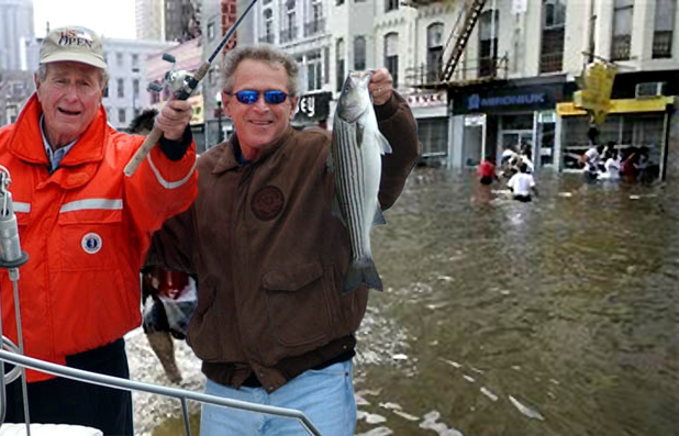 [/img]
Good luck to anyone in Irene’s path. Combine Irene with the cold front that just moved through my back yard last night and it could really get nasty.
Positive thoughts heading eastward today.
Thinker
I’m headed to Lowes tonight to get an additional hand held pump and a tree branch cutter.
I doubled the size of my sump pump after my basement flood last Fall. If my basement floods again, I might go ballistic.
Krugman must be giddy. Imagine the benefits to our economy from rebuilding NYC and NJ.
i’m in pittsburgh and this is beyond my comprehension. seriously mind-blowing. a coworker with vacation property in maine is leaving today to go tend to his place. my friend in ocean city is cutting vacation short and getting the fuck outta dodge. in my 32 years i haven’t witnessed anything like this on the east coast.
Wildwood and Ocean City have major drainage issues. If it is high tide and you get a thunderstorm, the sewers can’t drain. They immediately back up and start flooding the streets. If you combine 12 inches of rain with a storm surge, the South Jersey shore points will be devastated. That is without the 100 mph winds.
The Atlantic City Casinos aren’t built for 100 mph winds. The windows will be blown in. There is only one way off the island and it floods easily. This could be one for the ages.
Admin,
WOW.
Forecasts are often wrong. So wrong, so often, that we laugh about it …a lot.
But this year is especially worrisome. Mother Nature has met AND exceeded forecasts on a number of memorable occasions already.
If ever there was a time to “prepare for the worst and hope for the best”, this is one.
If I were in Irene’s path, I would at least be verrry worried.
Best of luck to everyone. May this forecast turn out to be a huge FAIL.
Krugman might get a chance to realize that the “economic benefit” of disaster isn’t worth the anguish and destruction. Then again, the pills he probably pops won’t allow such reflection.
My thoughts are with you all over there…
Jersey shores just needs to install grease traps in the storm drains, I’m sure it will work wonders.
People on Long Island shoud GTFO now. The tunnels and bridges close when the wind reaches 50 mph and things will be gridlock long before that.
I predict panic to ensue by tomorrow morning.
Let’s see how the billions we’ve spent on emergency preparedness by our governments works out.
Government promises us safety and security. Now is their time to shine.
I hope Howard’s in the fog grabbing a burrio or a redrum burger this weekend.
Hurricane Irene forecast shifts west, impacts on N.J. could be severe
As Hurricane Irene nears, Gov. Christie declares a state of emergency to mobilize National Guard
State and National Weather Service officials are urging New Jersey residents to prepare for Hurricane Irene now, as several factors could align to make the impacts of the approaching cyclone potentially disastrous for New Jersey.
It’s important to note we are still days away from Irene, which was packing 115 mile per hour winds this morning as it swirled through the Bahamas, making its closest approach to the state and forecasts could still change. But as of this morning, forecasts have Irene tracking within miles of the New Jersey coast as a hurricane Sunday (see interactive map below), and the impacts of the storm statewide could be severe.
“Everyone should be preparing for this storm as now is the time. Have a plan in place,” wrote Dean Iovino and Michael Gorse, meteorologists at the National Weather Service in Mount Holly, in their morning forecast discussion. “Everything remains on the table with this hurricane, which includes widespread damaging winds, torrential rain, coastal flooding, dangerous rip currents/waves and beach erosion.”
Current forecast guidance suggests Hurricane Irene will turn northward today and tomorrow as it approaches the North Carolina coast. The National Hurricane Center said it appears a trough will form along the east coast, providing an alleyway for the cyclone to travel northward rather than curl out to sea.
Hurricane Watches were issued along the North Carolina coast this morning, and tropical storm watches extend further south along South Carolina and Georgia. At this time, it appears the greatest impacts from Irene would be felt in New Jersey overnight Saturday through about midday Sunday, according to NWS Mount Holly.
A number of other factors play into Irene’s impact on New Jersey. According to New Jersey state climatologist at Rutgers University David Robinson, New Jersey’s statewide average for rainfall this month is already more than double what it typically is, while some towns in the state appear to have already tripled their average August rainfall.
As a result, the soil is already fairly saturated, leaving river levels above average and making it easier for trees to be uprooted by high winds. In southern New Jersey, among the hardest hit by August rains, several dams failed during a storm two weeks ago, prompting inspections of dozens of others in the region.
To make matters worse, a storm system is expected to bring heavy rains, and perhaps flash flooding, to parts of the state today – which would only exacerbate existing conditions ahead of Irene.
Along the coast, the storm is set to coincide with a new moon, meaning that high tides will already be above normal levels. This could make any coastal flooding impacts of Irene more severe.
State officials have been monitoring the storm and are urging New Jersey residents to prepare for the worst now.
“We’re telling people, ‘ listen, take today and tomorrow to prepare. Don’t wait.’ Have a full tank of gas, plenty of food in the house, blankets and clothes in your car. Make sure you’re prepared just in case,” said state police Sgt. Brian Polite, noting evacuation plans, should they be necessary are in place and ready to be activated. “Right now, we’re watching, waiting and getting ready.”
Notice to N.J residents.: I’ve got a house for sale about 15 miles north of Savannah. Hurricane shutters(never used) included in price.
I am just luvin’ it.
Here on the Gulf Coast, when we were about to be hammered by Hurricane Ike, remember, the LARGEST Hurricaine ever to hit the US, and those assholes on the East Coast were licking their chops hoping that all us NASCAR loving, cheese-doodle eating rednecks would be wiped off the map.
Well, we were NOT. We evacuated only those people in the projected storm surge. Our LOCAL officials ringed the Houston Metroplex with electrical boom trucks, ice, food, whatever, so the minute the winds went down, these people went to work. The only thing the witless FEMA people did was run around with blue tarps for your roof, rolls eyes.
98% of the Houston Metroplex grid went down, 6 MILLION people were without electricity for up to 7-10 days. Did you hear about rioting or looting or mayhem? No.
What has happened in EVERY SINGLE grid down situation on the East Coast? Why, I do believe, it is RIOTING, LOOTING, MAYHEM – and a baby boom 9 months later.
Makes you wonder who the civilized people in this country really are.
Personally, I am hoping for a 30 foot storm surge right up the Potomac, preferably when all the branches of the fed.gov are at work.
HopeZK: I was raised in Texas (little pecker), Mississippi and Florida. Lived everywhere in the lower 48. Prefer down home rednecks for neighbors (that includes those from AL, GA,SC and parts of AR,NC and TN) to anyone else.. Except maybe Idaho.. Homesteaded there during a midlife crises and discovered so damn many ex-Chippies from CA that I felt I was surrounded by an extremely polite army all the time. No home without artillery, veggie swap meets all summer – I’d come home from school (finishing up a degree at the time) and find boxes of veggies on my front porch with no idea where they came from.
I’d have to cruise around checking gardens so I’d know who to pay back..
I’d like to see that in N. VA or Long Island..
Florida has a limited number of RNs due to imported MidWesterners. Mostly Ohio, Indiana and IL.
I know who the civilized ones really are and they are us.
MA
[img [/img]
And some more from CNN:
Three governors declared states of emergency Thursday as Hurricane Irene threatened to wreak havoc along the United States’ Eastern Seaboard.
Virginia Gov. Bob McDonnell and New Jersey Gov. Chris Christie declared emergencies for their states, while North Carolina Gov. Beverly Perdue declared a state of emergency in counties east of Interstate 95. The emergency declarations allow states to free funds and prepare resources that may be needed.
If Irene continues along its current track, “from a flooding perspective, this could be a hundred-year event,” Christie said. He encouraged voluntary evacuations to begin immediately. “Anybody who is on a barrier island should go,” he said, adding that on Friday people along the beaches should start thinking about moving to higher ground.
Christie said it was too soon to know whether there will be mandatory evacuations.
In parts of North Carolina, mandatory evacuations were under way Thursday.
The military moved more than two dozen ships out to sea ahead of the storm.
As of 11 a.m. ET, the Category 3 storm was pounding the northwestern Bahamas, with its core approaching Abaco Island, the National Hurricane Center said.
“The core of the hurricane will continue to move over the northwestern Bahamas today, and pass well offshore of the east coast of central and north Florida tonight and early Friday. The hurricane is forecast to approach the coast of North Carolina on Saturday,” the center’s advisory said.
Maximum sustained winds were at 115 mph as the storm worked its way northwest.
State Of Emergency Issued For New Jersey, Voluntary Evacuations For Jersey Shore
Submitted by Tyler Durden on 08/25/2011 13:15 -0400
And so the Irene-induced state of emergency pronouncements start trickling in. First, New Jersey Governor Chris Christie signed a state of emergency order and urged people at the Jersey Shore to leave voluntarily by mid-day tomorrow as Hurricane Irene approaches the Northeast. The governor, in a briefing with reporters, said he was considering a mandatory evacuation of the Jersey Shore area. Following this news is the announcement by the US coast guard which issued a hurricane alert for Long Island sound. But the biggest losers? Insurance companies: both Chubb and Allstate CDS have spiked on expectations this hurricane could be a doozy in claim terms (although we urge readers to check their hurricane insurance: many times the deductible is far higher if the damage is caused by a Hurricane than a Tropical Storm: alas, this may be a saving grace for some insurance cos). What would be amusing is if the biggest loser out of today, now that BAC is threatening to close read for the day, is Berkshire’s insurance empire.
@Admin: I’m luvin’ that red line in your hurricane track..
With any luck, Irene will take out the entire East Coast Progressive (Democrat) Infestation.
I just received info that Wildwood must be evacuated by noon tomorrow. No one can enter or leave after that time.
ALERT FROM CITY OF PHILA
The National Weather Service forecast has worsened since yesterday. The official track has moved to the west and Hurricane Irene is expected to track closer to Philadelphia. This potential track means heavier rain and higher winds. If the current forecast holds or the track moves even further west, the combination of rain and wind will make Irene the worst hurricane to hit Philadelphia in at least 50 years.
– Rain could start as early as Friday night ahead of the hurricane.
– Heavy rains could affect Philadelphia through Sunday.
– Heavy winds could affect the city Saturday night into Sunday. High winds may continue after the tropical storm passes.
With the current forecast track, Philadelphia can expect the following:
– Rainfall exceeding 7″, which would send all streams, creeks, and the Schuylkill River into flood stage. Flash flooding in streets and low lying areas could also be expected. Tidal flooding along the Delaware River is also possible.
– Sustained winds of 40-50 mph with gusts to 60 mph or higher. This level of winds could cause downed trees, power outages, and other infrastructure disruption.
To date, August has been the 2nd rainiest month in Philadelphia s history. So rainfall from Irene could cause severe flooding in the city.
Philadelphia has many flood prone areas, including but not limited to:
– Cobbs Creek and the marsh lands in the southwest sector of the City;
– Other City creeks & streams including Pennypack, Poquessing, Tacony, Frankford, and Wissahickon Creeks;
– Main Street Manayunk;
– Portions of the Philadelphia Naval Base;
– Delaware River which is usually first observed along Delaware Ave & Ben Franklin Bridge;
– In the Northeast where Linden Avenue meets the Delaware; and
– Kelly and Lincoln Drives.
Flooding may involve numerous hazardous conditions, including moving water, washed-out roads, damage to utility systems, and damage to structures.
It is strongly recommended that Philadelphians living in flood prone areas make alternative arrangements to stay with family or friends whose homes are not prone to flooding for the course of this event and until the flooding threat subsides.
If you are driving and encounter flood waters or standing water, do not attempt to drive your vehicle through the water. Try to find an alternate route or wait until the water recedes.
Cool interactive hurricane site:
http://www.stormpulse.com/hurricane-irene-2011
This should get some action. It is not a coincidence that the trend for natural diasters has them more frequent and more intense. This is true for hurricanes, earthquakes, tsunamis or any other so called act of God. Despite what Al Gore has to say, it has nothing to do with man made global warming. Those of you who are Bible scholars, will acknowledge that Matthew 24 informs those who care to study the Word that these things are a sign of the period before the Great Tribulation;. commonly referred to as “birth pains”. We have always had these things happen during the history of mankind but it is obvious that when they happen now, they are much worst. Expect more.. If we have a major earthquake along the New Madrid fault, it will impact almost every state east of the Mississippi. We live in exciting times, get ready.
MY SECTION 8 NEIGHBOR IN WILDWOOD ON SUNDAY
[img [/img]
BULLETIN
HURRICANE IRENE ADVISORY NUMBER 22
NWS NATIONAL HURRICANE CENTER MIAMI FL AL092011
500 PM EDT THU AUG 25 2011
…IRENE STILL BATTERING ABACO ISLAND…NEW WATCHES AND WARNINGS
ISSUED FOR THE EAST COAST OF THE UNITED STATES…
SUMMARY OF 500 PM EDT…2100 UTC…INFORMATION
———————————————-
LOCATION…27.0N 77.3W
ABOUT 575 MI…930 KM S OF CAPE HATTERAS NORTH CAROLINA
MAXIMUM SUSTAINED WINDS…115 MPH…185 KM/H
PRESENT MOVEMENT…NNW OR 335 DEGREES AT 14 MPH…22 KM/H
MINIMUM CENTRAL PRESSURE…950 MB…28.05 INCHES
WATCHES AND WARNINGS
——————–
CHANGES IN WATCHES AND WARNINGS WITH THIS ADVISORY…
THE GOVERNMENT OF THE BAHAMAS HAS DISCONTINUED THE HURRICANE WARNING
FOR THE CENTRAL BAHAMAS.
A TROPICAL STORM WARNING HAS BEEN ISSUED FOR THE COAST OF SOUTH
CAROLINA FROM EDISTO BEACH NORTHWARD TO LITTLE RIVER INLET.
A HURRICANE WARNING HAS BEEN ISSUED FOR THE COAST OF NORTH CAROLINA
FROM LITTLE RIVER INLET NORTHWARD TO THE VIRGINIA BORDER…
INCLUDING THE PAMLICO…ALBEMARLE…AND CURRITUCK SOUNDS
A HURRICANE WATCH HAS BEEN ISSUED FOR THE EAST COAST OF THE UNITED
STATES FROM THE VIRGINIA/NORTH CAROLINA BORDER NORTHWARD TO SANDY
HOOK NEW JERSEY…INCLUDING DELAWARE BAY…AND THE CHESAPEAKE
BAY SOUTH OF SMITH POINT.
A TROPICAL STORM WATCH HAS BEEN ISSUED FOR THE CHESAPEAKE BAY FROM
SMITH POINT NORTHWARD AND THE TIDAL POTOMAC.
SUMMARY OF WATCHES AND WARNINGS IN EFFECT…
A HURRICANE WARNING IS IN EFFECT FOR…
* THE NORTHWESTERN BAHAMAS
* THE COAST OF NORTH CAROLINA FROM LITTLE RIVER INLET NORTHWARD TO
THE VIRGINIA BORDER…INCLUDING THE PAMLICO…ALBEMARLE…AND
CURRITUCK SOUNDS
A HURRICANE WATCH IS IN EFFECT FOR…
* THE VIRGINIA/NORTH CAROLINA BORDER NORTHWARD TO SANDY HOOK NEW
JERSEY…INCLUDING DELAWARE BAY…AND CHESAPEAKE BAY SOUTH OF SMITH
POINT.
A TROPICAL STORM WARNING IS IN EFFECT FOR…
* NORTH OF EDISTO BEACH SOUTH CAROLINA TO LITTLE RIVER INLET
A TROPICAL STORM WATCH IS IN EFFECT FOR…
* CHESAPEAKE BAY FROM SMITH POINT NORTHWARD AND THE TIDAL POTOMAC.
A HURRICANE WARNING MEANS THAT HURRICANE CONDITIONS ARE EXPECTED
SOMEWHERE WITHIN THE WARNING AREA. A WARNING IS TYPICALLY ISSUED
36 HOURS BEFORE THE ANTICIPATED FIRST OCCURRENCE OF
TROPICAL-STORM-FORCE WINDS…CONDITIONS THAT MAKE OUTSIDE
PREPARATIONS DIFFICULT OR DANGEROUS. PREPARATIONS TO PROTECT LIFE
AND PROPERTY SHOULD BE RUSHED TO COMPLETION.
A TROPICAL STORM WARNING MEANS THAT TROPICAL STORM CONDITIONS ARE
EXPECTED SOMEWHERE WITHIN THE WARNING AREA WITHIN 36 HOURS.
A HURRICANE WATCH MEANS THAT HURRICANE CONDITIONS ARE POSSIBLE
WITHIN THE WATCH AREA. A WATCH IS TYPICALLY ISSUED 48 HOURS
BEFORE THE ANTICIPATED FIRST OCCURRENCE OF TROPICAL-STORM-FORCE
WINDS…CONDITIONS THAT MAKE OUTSIDE PREPARATIONS DIFFICULT OR
DANGEROUS.
A TROPICAL STORM WATCH MEANS THAT TROPICAL STORM CONDITIONS ARE
POSSIBLE WITHIN THE WATCH AREA…GENERALLY WITHIN 48 HOURS.
INTERESTS ELSEWHERE IN THE MID-ATLANTIC STATES AND NEW ENGLAND
SHOULD MONITOR THE PROGRESS OF IRENE.
FOR STORM INFORMATION SPECIFIC TO YOUR AREA IN THE UNITED
STATES…INCLUDING POSSIBLE INLAND WATCHES AND WARNINGS…PLEASE
MONITOR PRODUCTS ISSUED BY YOUR LOCAL NATIONAL WEATHER SERVICE
FORECAST OFFICE. FOR STORM INFORMATION SPECIFIC TO YOUR AREA OUTSIDE
THE UNITED STATES…PLEASE MONITOR PRODUCTS ISSUED BY YOUR NATIONAL
METEOROLOGICAL SERVICE.
DISCUSSION AND 48-HOUR OUTLOOK
——————————
AT 500 PM EDT…2100 UTC…THE CENTER OF HURRICANE IRENE WAS LOCATED
NEAR LATITUDE 27.0 NORTH…LONGITUDE 77.3 WEST. IRENE IS MOVING
TOWARD THE NORTH-NORTHWEST NEAR 14 MPH…22 KM/H. THIS MOTION IS
EXPECTED TO CONTINUE THROUGH TONIGHT WITH A TURN TOWARD THE NORTH
BY EARLY FRIDAY. ON THE FORECAST TRACK…THE CORE OF THE
HURRICANE WILL MOVE NORTH OF THE NORTHWESTERN BAHAMAS TONIGHT…AND
PASS WELL OFFSHORE OF THE EAST COAST OF CENTRAL AND NORTH FLORIDA
TONIGHT AND EARLY FRIDAY. THE HURRICANE IS FORECAST TO APPROACH
THE COAST OF NORTH CAROLINA ON SATURDAY.
MAXIMUM SUSTAINED WINDS ARE NEAR 115 MPH…185 KM/H…WITH HIGHER
GUSTS. IRENE IS A CATEGORY THREE HURRICANE ON THE SAFFIR-SIMPSON
HURRICANE WIND SCALE. SOME STRENGTHENING IS POSSIBLE TONIGHT AND
FRIDAY.
IRENE IS A LARGE TROPICAL CYCLONE. HURRICANE FORCE WINDS EXTEND
OUTWARD UP TO 80 MILES…130 KM…FROM THE CENTER…AND TROPICAL
STORM FORCE WINDS EXTEND OUTWARD UP TO 290 MILES…465 KM.
THE LATEST MINIMUM CENTRAL PRESSURE REPORTED BY RECONNAISSANCE
AIRCRAFT IS 950 MB…28.05 INCHES.
HAZARDS AFFECTING LAND
———————-
WIND…HURRICANE AND TROPICAL STORM CONDITIONS ARE OCCURRING OVER
PORTIONS OF THE NORTHWESTERN BAHAMAS…BUT SHOULD BEGIN TO DIMINISH
OVERNIGHT. TROPICAL STORM FORCE WINDS ARE EXPECTED WITHIN THE
SOUTHERN PORTION OF THE WARNING AREA ALONG THE UNITED STATES EAST
COAST BY LATE FRIDAY. HURRICANE FORCE WINDS ARE EXPECTED TO FIRST
REACH THE HURRICANE WARNING AREA BY SATURDAY.
STORM SURGE…IN THE NORTHWESTERN BAHAMAS IN AREAS OF ONSHORE WINDS
NEAR THE CENTER OF IRENE…AN EXTREMELY DANGEROUS STORM SURGE WILL
RAISE WATER LEVELS BY AS MUCH AS 7 TO 11 FEET ABOVE NORMAL TIDE
LEVELS OVER THE NORTHWESTERN BAHAMAS. WATER LEVELS WILL GRADUALLY
SUBSIDE OVER THE CENTRAL BAHAMAS TONIGHT. NEAR THE COAST…THE
SURGE WILL BE ACCOMPANIED BY LARGE AND DANGEROUS WAVES.
STORM SURGE…ALONG THE EASTERN COAST OF THE UNITED STATES…AN
EXTREMELY DANGEROUS STORM SURGE WILL RAISE WATER LEVELS BY AS MUCH
AS 5 TO 10 FEET ABOVE GROUND LEVEL WITHIN THE HURRICANE WARNING
AREA INCLUDING THE ABLEMARLE AND PAMLICO SOUNDS. NEAR THE
COAST…THE SURGE WILL BE ACCOMPANIED BY LARGE…DESTRUCTIVE… AND
LIFE-THREATENING WAVES. IRENE ALSO HAS THE POTENTIAL TO PRODUCE
SIGNIFICANT STORM SURGE FLOODING WITHIN THE HURRICANE WATCH AREA
INCLUDING PORTIONS OF THE CHESAPEAKE BAY…TRIBUTARIES…AND THE
EASTERN SHORE.
RAINFALL…IRENE IS EXPECTED TO PRODUCE RAINFALL ACCUMULATIONS OF 6
TO 12 INCHES OVER THE NORTHERN BAHAMAS. STORM TOTAL RAINFALL
AMOUNTS OF 6 TO 10 INCHES WITH ISOLATED MAXIMUM AMOUNTS OF 15
INCHES IS EXPECTED OVER PORTIONS OF EASTERN NORTH CAROLINA AND IN
THE MID-ATLANTIC STATES ALONG THE PATH OF IRENE.
SURF…SWELLS GENERATED BY IRENE ARE AFFECTING PORTIONS OF THE COAST
OF THE SOUTHEASTERN UNITED STATES. THESE SWELLS WILL CAUSE
LIFE-THREATENING SURF AND RIP CURRENT CONDITIONS.
NEXT ADVISORY
————-
NEXT INTERMEDIATE ADVISORY…800 PM EDT.
NEXT COMPLETE ADVISORY…1100 PM EDT.
$$
FORECASTER BROWN
HURRICANE IRENE DISCUSSION NUMBER 22
NWS NATIONAL HURRICANE CENTER MIAMI FL AL092011
500 PM EDT THU AUG 25 2011
THE EYE OF IRENE MOVED OVER ABACO ISLAND EARLIER THIS AFTERNOON. AN
AUTOMATED WEATHER STATION ON THE ISLAND MEASURED A MINIMUM PRESSURE
OF 950.4 MB AROUND 1700 UTC. THE AIR FORCE RESERVE HURRICANE HUNTER
AIRCRAFT INVESTIGATING IRENE THIS AFTERNOON HAS REPORTED A 700 MB
PEAK-FLIGHT WIND OF 99 KT. ALTHOUGH RECENT AIRCRAFT DATA DO NOT
QUITE SUPPORT THE 100-KT ADVISORY INTENSITY…WE WILL HOLD THE
INTENSITY FOR A LITTLE LONGER TO SEE IF THE AIRCRAFT FINDS HIGHER
WINDS.
IRENE CONTINUES MOVING NORTH-NORTHWESTWARD AT ABOUT 12 KT. THERE HAS
BEEN NO CHANGE TO THE TRACK FORECAST REASONING. IRENE IS FORECAST
TO TURN NORTHWARD BY EARLY FRIDAY AS IT MOVES THROUGH A BREAK IN
THE SUBTROPICAL RIDGE. AFTER 24 HOURS…THE HURRICANE IS EXPECTED
TO MOVE ON A HEADING BETWEEN NORTH AND NORTH-NORTHEAST AS A TROUGH
BYPASSES THE CYCLONE TO THE NORTH. THIS WILL LEAVE THE IRENE IN A
STEERING PATTERN THAT SHOULD KEEP THE HURRICANE ON THAT GENERAL
HEADING AS IT MOVES VERY NEAR OR OVER MID-ATLANTIC COAST. THE TRACK
GUIDANCE HAS COME INTO BETTER AGREEMENT ON THIS SOLUTION…AND THE
CONFIDENCE IN THE TRACK FORECAST IS INCREASING. THE NEW TRACK HAS
BEEN NUDGED WESTWARD AND IS CLOSE TO THE CENTER OF THE GUIDANCE
ENVELOPE. IT IS ALSO IN GOOD AGREEMENT WITH THE 1200 UTC GFS. SINCE
IRENE IS A LARGE TROPICAL CYCLONE…ONE SHOULD NOT FOCUS ON THE
EXACT TRACK OF IRENE…AS SIGNIFICANT IMPACTS WILL BE FELT WELL
AWAY FROM THE CENTER.
THERE IS STILL SOME TIME FOR IRENE TO STRENGTHEN AS IT WILL BE
MOVING OVER WARM WATER AND THE SHEAR REMAINS LOW. HOWEVER…THE
UPDATED FORECAST CALLS FOR A LITTLE LOWER INTENSITY OVER
THE FIRST 24-36 HOURS. IN ABOUT 48 HOURS…SOUTHWESTERLY SHEAR IS
FORECAST TO INCREASE…WHICH SHOULD START A WEAKENING PROCESS.
HOWEVER…SINCE IRENE HAS SUCH A LARGE AND INTENSE CIRCULATION…
IT WILL PROBABLY BE SLOW TO WEAKEN.
FORECAST POSITIONS AND MAX WINDS
INIT 25/2100Z 27.0N 77.3W 100 KT 115 MPH
12H 26/0600Z 28.7N 77.8W 100 KT 115 MPH
24H 26/1800Z 30.6N 77.8W 105 KT 120 MPH
36H 27/0600Z 32.5N 77.4W 100 KT 115 MPH
48H 27/1800Z 34.5N 76.9W 95 KT 110 MPH
72H 28/1800Z 39.8N 74.6W 75 KT 85 MPH…INLAND
96H 29/1800Z 48.5N 68.0W 50 KT 60 MPH…POST-TROP/EXTRATROP
120H 30/1800Z 56.0N 54.0W 45 KT 50 MPH…POST-TROP/EXTRATROP
$$
FORECASTER BROWN
Furthermore: There are only three bridges out and they will be closed as soon as winds hit 50 mph. Tunnels will be closed long before the storm surge arrives. From our work on Hurricane Earl last year we know at Collapsenet that the Red Cross itself has said it might be a week before they could get onto the island with any substantial relief in the event of a Cat 2 or 3 storm. Buildings on L.I. haven’t seen a hurricane in decades and are ill prepared. Older buildings and brick buildings are extremely vulnerable and would be very dangerous in high winds.
About five years ago a U.S. government report stated unequivocally that a Cat 2 or 3 on Long Island would be worse in terms of damage and death than Katrina in New Orleans. There are six million people on Long Island and they will be trapped, essentially making the island one big Superdome with no exits. For those who escape unhurt, fresh water will be the most important issue, followed by shelter, food and sanitation.”
1) Are you going to have some before/after photos of the 30 Blocks? Better label them or we might all get the after/before reversed.
2) How’s that condo going for ya? I’ll over $100 for it, if you can offer a nonrecourse loan with 100,000% LTV.
[img [/img]
What happened to “fun wif hurricanes”? I still wouldn’t wish what is going to happen on anyone, even a bunch of yankees. Imagine this weak dick storm X 10, that was Andrew.
A great website for all of you fuckers that normally don’t give a shit about this stuff is wunderground. Go to tropical maps.
Jim,
Seriously, don’t evacuate. I’ve been through so many hurricanes and only evacuated once, for a cat5, and immediately regretted it. Nothing happened.
The most I’ve ever dealt with was loss of electricity, so we grilled up everything in the freezer. No big deal. Just stock up on charcoal and have some water handy in case you lose water service. My neighbor lost water last time, but we just hooked a hose up and they were fine until water was restored.
They go completely overboard with their warnings, and I’ll never worry about it again. Trust me. I’d rather be home in my own house, than stuck out on the road, in the worst traffic jam you could imagine, panicking over a storm.
newsjunkie
I’m 30 miles northwest of Philly and 120 miles from the coast. There won’t be evacuations here. The evacuations are at the beaches. There is no way I’d stay in Wildwood during this.
“25th August 2011 at 4:29 pm
Administrator says:
I just received info that Wildwood must be evacuated by noon tomorrow. No one can enter or leave after that time.”
I’m sorry, but shouldn’t that be the policy year round?
“A TROPICAL STORM WARNING HAS BEEN ISSUED FOR THE COAST OF SOUTH
CAROLINA FROM EDISTO BEACH NORTHWARD TO LITTLE RIVER INLET.”
That’s about 50 miles north of me. Could use some of that rain though. If this storm decides to turn at the last minute we’re screwed, because nobody in these parts is expecting anything here.
Admin,
get your amps off the floor this time. Seriously though, I hope the best for you and your family. keep us posted over the weekend to let us know how you are doing.
matt
Kevin took the Amp to Penn State with him. My biggest concern is if we lose power and the battery backup sump pump can’t keep up. I will be one pissed off Admin if I lose my basement again.
Jersey Shore might be somewhere in Ohio by Sunday.
Admin and all those in the path… stay safe! Let us know what is happening… if you can.
Ocean City, MD. is where I spent alot of summer beach days. There is one spot, I think around 64th street, where the ocean and bayside are very close together. The storm surge may very well cut of the lower part of OC if the water level of the bay gets too high.
Good luck everyone!
matt
OC Maryland has already been evacuated.
I’m looking at this as a test run for the bad times ahead. Getting through the tough times will require cooperation and helping out neighbors. Robmu1 and I proved that tonight. On my way home from work I stopped at Lowes and picked up two pumps and met Rob in a parking lot near our houses to give him one of the pumps. And I didn’t even gouge him on the price. I won’t worry about supplies and water as I’ve accumulated plenty of supplies over the last year. If we can’t cook, I’ve got cooking options powered by propane. We’ll see if there are things I didn’t consider over the next few days.
Hey Admin,
Hurricane Hugo nearly wiped my ass off the map in ’89 as it came over my house at 130mph and I was 110 miles from the coast! My wife was in the USAF at the time and was required to stay put. If we had it to do over again we would have headed for the mountains of Tennessee because AWOL is better than dead. If you can get out, do so. If not find a fortress like place to ride it out. A concrete structure below ground level with an exit in case it floods is good. I feel for you and the rest of the east coast. Remember to keep your head down. It’s not the winds that get you, it’s the shit IN the wind that does you in.
I don’t know you but you seem like a sensible guy so you should be fine. Common sense goes a very long way in situations like this. All the best to you and yours! We’ll see you on the other side.
I_S
I live in fairfield county in Connecticut so we will seriously get wacked. In a twisted sort of way i ahve enjoyed hurricanes, but this one looks to be much then the one i remembered in my youth.
Never underestimate the stupidity of some people http://www.wesh.com/r-video/28983987/detail.html